Log in
All resources
Create a design
172 Free Artworks of Expedition Maps
bibliothèque nationale de france
considérations géographiques et physiques sur les nouvelles découvertes au nord de la grande mer
maps in the rijksmuseum amsterdam
too late for gordon and khartoum (1887) by macdonald
maps of the mahdist war
a voyage to abyssinia, and travels into the interior of that country, executed under the orders of the british government in the years 1809 & 1810
john outhett
alexander macpherson (engraver)
romanticism,fairy painting
narrative of a five years' expedition (1806)
old maps of south africa
emil holub
from edinburgh to the antarctic. an artist's notes and sketches during the dundee antarctic expedition of 1892-93
port stanley, ontario
maps by peter lesley
maps by james hall
reconstruction of ruysch's africa map by stanley
new light on dark africa (dulcken)
atlas van der hagen (volume 4)
atlas van der hagen
naval battles involving the ottoman empire in art
bombardment of algiers (1783)
corona and coronet (1898)
1890s maps of japan
corona and coronet (1898)
travel maps of the world
1770s maps of alaska
robert de vaugondy
considérations géographiques et physiques sur les nouvelles découvertes au nord de la grande mer
1755 maps of north america
maps by guillaume delisle showing history
old maps of alexander the great's empire
ismailïa. a narrative of the expedition to central africa for the suppression of the slave trade (1874)
diagrams, plots and charts from the british library mechanical curator collection
from edinburgh to the antarctic. an artist's notes and sketches during the dundee antarctic expedition of 1892-93
old maps of the south orkney islands
narrative of a five years' expedition (1806)
romanticism,fairy painting
woodcuts by cornelis anthonisz. in the rijksmuseum amsterdam
jan ewoutsz.
narrative of an expedition to the zambesi and its tributaries
david livingstone's travels in maps
considérations géographiques et physiques sur les nouvelles découvertes au nord de la grande mer
1750s maps of the russian empire
a & c black general atlas of the world
1850s maps of the world
nineveh and babylon - a narrative of a second expedition to assyria during the years 1849, 1850, and 1851 (1882)
maps of nimrud
nineveh and babylon - a narrative of a second expedition to assyria during the years 1849, 1850, and 1851 (1882)
maps of babylon
nineveh and babylon - a narrative of a second expedition to assyria during the years 1849, 1850, and 1851 (1882)
maps of babylon
discoveries among the ruins of nineveh and babylon (1859)
1859 maps
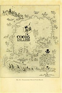
pirate
maps
maps of the arctic by gerardus mercator
maps by hendrik hondius the younger
westerners in the sanada treasure museum
everett d. graff collection of western americana
st. louis, missouri in the 1800s
too late for gordon and khartoum (1887) by macdonald
maps of the mahdist war
maps from the earth and its inhabitants, vol. xvi
surveying in mexico
travels in the interior of north america, during the years 1832–1834
works by maximilian zu wied-neuwied
1877 maps of the united states
1870s maps of utah
too late for gordon and khartoum (1887) by macdonald
maps of the mahdist war
voyage dans la russie méridionale et la crimée (1840-1842) par anatolii nikolaevich demidov
library of congress
a voyage to abyssinia, and travels into the interior of that country, executed under the orders of the british government in the years 1809 & 1810
john outhett
old maps of yosemite valley
john e. weyss
considérations géographiques et physiques sur les nouvelles découvertes au nord de la grande mer
hokkaido in art
too late for gordon and khartoum (1887) by macdonald
maps of the mahdist war
1740s maps of the world
maps by emanuel bowen
considérations géographiques et physiques sur les nouvelles découvertes au nord de la grande mer
isla de los estados
1696 maps of the caribbean
1690s maps of mexico
too late for gordon and khartoum (1887) by macdonald
maps of the mahdist war
maps by daniel lizars
1820 maps of asia
considérations géographiques et physiques sur les nouvelles découvertes au nord de la grande mer
old maps of the yellow sea
ludwig becker (explorer)
frederick schoenfeld
1750s maps of california
philippe buache
across the sub-arctics of canada (1898)
arthur heming
narrative of a five years' expedition (1806)
romanticism,fairy painting
too late for gordon and khartoum (1887) by macdonald
maps of the mahdist war
too late for gordon and khartoum (1887) by macdonald
maps of the mahdist war
considérations géographiques et physiques sur les nouvelles découvertes au nord de la grande mer
eso island
considérations géographiques et physiques sur les nouvelles découvertes au nord de la grande mer
isla de los estados
considérations géographiques et physiques sur les nouvelles découvertes au nord de la grande mer
eso island
across the sub-arctics of canada (1898)
rangifer tarandus (illustrations)
across the sub-arctics of canada (1898)
arthur heming
across the sub-arctics of canada, a journey of 3,200 miles by canoe and snow shoe through the hudson bay region (1908)
old maps of canada
narrative of a five years' expedition (1806)
romanticism,fairy painting
narrative of a five years' expedition (1806)
romanticism,fairy painting
french-language maps of north america
1809 maps of north america
peninsula campaign
julius bien
a voyage to abyssinia, and travels into the interior of that country, executed under the orders of the british government in the years 1809 & 1810
john outhett
a voyage to abyssinia, and travels into the interior of that country, executed under the orders of the british government in the years 1809 & 1810
john outhett
a & c black general atlas of the world
19th-century celestial maps
a voyage to abyssinia, and travels into the interior of that country, executed under the orders of the british government in the years 1809 & 1810
john outhett
a voyage to abyssinia, and travels into the interior of that country, executed under the orders of the british government in the years 1809 & 1810
john outhett
prints by caspar luyken in the rijksmuseum amsterdam
maps in the rijksmuseum amsterdam
hms chanticleer (ship, 1808)
john heaviside clark
mappe-monde geo-hydrographique (sanson and jaillot, 1674)
prints by bernard picart in the rijksmuseum amsterdam
maps in the rijksmuseum amsterdam
prints by bernard picart in the rijksmuseum amsterdam
siege of sas van gent
prints by bernard picart in the rijksmuseum amsterdam
siege of schenkenschans 1636
overwintering on nova zembla by willem barentsz, 1596-1597
16th-century maps of the arctic
de vloot by den commandeur pieter vanden broecke ingebracht in't jaer 1630
etchings in the rijksmuseum amsterdam
history prints in the rijksmuseum amsterdam
maps in the rijksmuseum amsterdam
101 - 172 of 172
/ 2